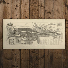
Our Edinburgh Map Print is a reproduction of the original "Plan de la Ville d’Edenbourg, capitale d’Ecosse (1647)", created by James Gordon, with kind permission from the National Library of Scotland.
The print is identical to the one displayed at the beginning of your tour at The Real Mary King's Close. It captures the intricate details of the city's layout and landmarks from the 17th century. Whether you're a map collector or simply intrigued by the past, this map print is a must-have addition to your collection.
Choose from a mounted or rolled print.


